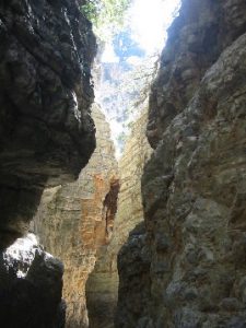
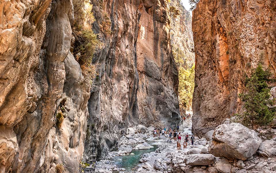
Crete

Rambling & Walking Crete Routes

Samaria Gorge

Rambling & Walking Crete Routes


SAMARIA GORGE

Samaria Gorge

The Samaria Gorge is normally a one way walk – from the top to the bottom. It emerges directly onto the sea shore near Agia Roumeli and you then need to take a boat trip back to civilisation where a bus takes you back to your starting point. It takes around 8 hours to complete the round trip – before you even get there and back.

You can do the Samaria Gorge ‘the easy way’. Take the boat from Hora Sfakia to the mouth of the gorge and go up half way and back again. Then get the boat back. There are small Cretan Tour operators who offer the trip as a day excursion. Try Monza travel in Matala.

Be sure to stop in Spilli on the way if drive yourself. It is worth a stop and there are some very inexpensive craft items to rummage through and take home with you. Take the waters from the lions mouths – it is reputedly very good for health and naturally clean directly from the spring in the hill just behind.

KAMARES CAVE

KAMARES CAVE

The Kamares Cave is a huge cavern where the Minoan pottery known as Kamares Ware was found. The entrance is over 40m. wide and almost 20m. high. It is possible to explore with the cave and the fissure where the cache of pottery was found can be seen the cavern floor near the back.

To walk to the Kamares Cave begin by heading east through the village of Kamares from the church. Turn left by the kafenions and take the left fork in the path, which ascends directly uphill. At the three way junction remain on the paved path to the left (25th March Street). You then come to the road and a sign clearly points the way to the 'CAVE OF KAMARES' across the road to a concrete track. The concrete path changes to a dirt track and soon the E4 signpost can be found. (E4 is a European Hiking route, which traverses right across the island).

Follow the E4 route from here by turning hard right avoiding the path to the water tank ahead. The path ascends sharply and passes the E4 signpost on the tree and there are a number of old red way-markers along the route. A water culvert appears on the right of the path, which offers refreshment for walkers most of the way up.

Cave of Kamares

At a track-end the path turns left then right by some animal drinking troughs. Follow the path past the next E4 signpost where it forks right and crosses the hillside. Cairns assist the direction and the route passes a ravine with a viewpoint and then a trough where water flows from the mountain springs.

The path continues through a tree copse and then loses its steepness across a rocky area before more trees and ascending again. The path follows the E4 signposts and the water and soon forks to the right by a water trough.

The path here becomes very steep, but is easily followed via the E4 signposts to a concrete water cistern where it turns right marked by red way-markers. The path becomes really steep next and soon the cave entrance can be seen. (There are several cairns marking the way to it). There is a large rock outcrop with red arrows pointing the way towards two oak trees - the entrance is reached soon from here. The trek up takes around 3 hours, but the return journey is a little quicker - around 2˝ hours.
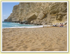
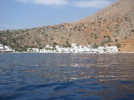
KALAMAKI & KOMMOS


KALAMAKI & KOMMOS

From the square in Pitsidia village, walk down through the village towards the church and bear right just before you approach it down towards the cemetary. Take the road north opposite the cemetery, through some small-holdings and turn left just before the river-bed. (If you continue straight on the track will take you to the village of Kamilari).

From the platia in Pitsidia village, walk down through the village towards the church and bear right just before you approach it down towards the cemetary. Take the road north opposite the cemetery, through some small-holdings and turn left just before the river-bed. (If you continue straight on the track will take you to the village of Kamilari).

Along here there are some very old olive trees.

After your swim and / or refreshment follow the beach south (left) all the way to Kommos, where the archaeological site is. Turn left here and follow the track around the archaeological site and the road becomes paved.

loggos

Follow the paved road straight across the cross roads, past the sandy vineyards, fig trees and allotments. There are some amazing little buildings that locals have constructed for when they spend time cultivating their land.

Germanakis

From here there is a fantastic view of the two mountain ranges - the Lefka Ori (White Mountains) to the the left and the Psiloritis range to the right. In the spring the surrounding pasture are covered in flowers and there is still snow on the mountains, which give spectacular views.

This small valley is classified as 'archaelogical' and as such there is no development allowed (although there are some beautiful homes built on the upper slopes. Throughout this walk, keep a look-out for eagles and buzzards, which can be seen very often in this part of the Messara.

Towards the end of this road there is a fork in the road, the right hand which takes you opposite the bakery (a good place to stop for a coffee or beer), or left to the top of the village opposite the road to the church.

This is a circular walk of about 8km. and can be done in either direction.

RED BEACH

A walk up over the hill to Red Beach from Matala is also a must during your stay. The views are spectacular and the archaeology is prevalent everywhere on the path going up.

Do not forget that Red Beach is a nudist beach.

Take the steep concrete path opposite the Taverna Giannis near the quay. Here there are the remains of some old buildings cut into the hillside. There are also some long abandoned steps, which led down to the little church dedicated to the Annunciation of the Virgin Mary.

Stephano

These steps are inside the wall outline of a building and evidence that it was a concealed entrance - probably during the Ottoman occupation of Crete and Christians were persecuted for their faith.

The path to Red Beach is a scrabble up the slope to your right. There were once steps many years ago, but it is not too difficult to traverse. There is evidence of cutting blocks of stone out of the rock on the path. The way up then is relatively straightforward and climbs up the valley side.

Lefka Ori

In the valley below you will be able to see the grid-excavations of the old 'pre' and Roman settlement. As you approach the summit, be sure to notice the ancient petrified beach with sea anenomies, crabs and mussel shells in the 'seabed'.

Just before the summit, there is a fence to your left.

At the summit there is the opportunity to take a fork to your right to the view-point - looking right down the west coast of the this section of Crete. (You can also see the beach you are heading for). Pass through the gate in the fence - be sure to close it after you and follow one of the many paths down to the beach. There are sun-beds and umbrellas for hire in the summer season, but there are no refreshments or facilities.

Mediterranean seals use the beaches for sun-bathing and sea turtles for nesting, so keep a look-out for these wonderful happenings. The Libyan Sea is also host to many species of dolphins and whales.

Coming back, you can make a detour to your left after the summit and explore the remains of the extended fortress and the 'Koule' look-out post on the hill over-looking Matala.

matala

AGIO FARAGO GORGE

AGIO FARAGO GORGE

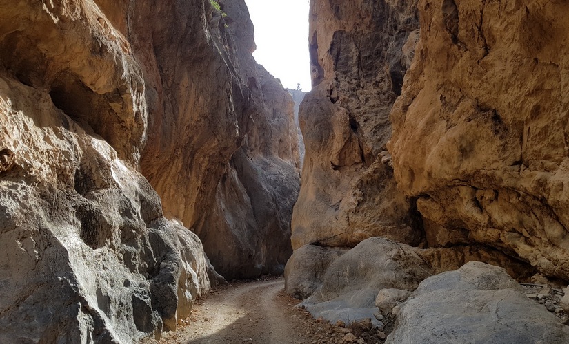
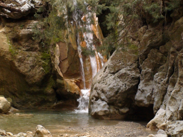
This is one of the 34 gorges dotted around Crete. It is by far not the largest, but none the less it is impressive. It will give you a flavour of the bigger gorges further west (Samaria and Imbros), which will take up virtually a whole day. The gorge of Agio Farago can be done in no longer than 3 hours there and back if you want to. It is best to start as early as possible in the morning cool and so as to gain as much shade from the sun as possible on the return walk.


Monastery of Odigitria

Go up to the Monastery of Odigitria. (This is worth a visit, if not this time.) It is signposted from the main road. The road from Sivas, through Listeros and beyond is exceptionally good all the way to the Monastery. Take the left road to Kali Lemenes, which soon becomes a dirt road and winds itself down through the valley.

If you have an ordinary road vehicle on hire, be very careful of the rocks on the track, because the insurance does not cover damage to tyres or to the underside of the vehicle.

The road is quite a good one despite it being not ‘made up’. When you get to a junction, take the right turn down the hill to a small parking area by the information board. This bit of the road is not so good, but can be traversed with extreme care. Park up either near the junction or the makeshift car park – watch out for large rocks sticking out of the road / car park bed. If you have an off-road vehicle you can drive beyond this point, but don’t even think about it with an ordinary road vehicle. The track is straightforward from here and leads you right down the ‘Gorge of the Saints’ to a small bay with a beach on the south coast overlooking the Libyan Sea. You can walk in the stream bed (hard going) or take the meandering path alongside. There are some impressive caves in the gorge sides on the way down. 250m. before the beach at Porofarango there is a small church cut into the rock face with a well – Aghios Andronios.

Originally it was a tiny church in a cave, but it has been extended outwards over the millennia and it’s present form dates from the 14th-15th C. It is purported that the first rites of the Christian faith were performed here, it being the area’s religious centre.

aghios andronios

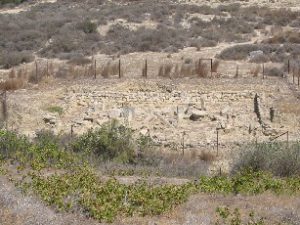
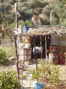
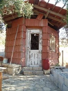
This was the only source of fresh water for miles around and people reputedly came from far and wide to collect their water from here.

To the south of the church, on a promontory a desecrated circular Minoan tomb has been discovered, demonstrating human presence since the Minoan era.

The scent of wild thyme and other herbs is quite noticeable and also the aroma of goat when they are around!

FARAGI ROUVAS GORGE

FARAGI ROUVAS GORGE

This walk begins at Ano Zaros, which has a small lake just above the village. The village is signposted from the main Heraklion road through Mires and Kappariana and is about 12 km to the north. The famous Zaros water bottling plant is nearby and a good deal of the bottled water in Southern Crete comes from the springs here out of the Psiloritis Mountains. There is a fish farm and taverna in the village that serve fresh trout.

The lake sports a taverna and bar, which are situated behind the lake - a good starting and finishing point. There is plenty of parking and the lake itself offers a pleasant ramble around its shores. There is an abundance of fish in the lake with a presence of swallows and kingfishers among the ducks and geese.

Agios Nilolaos

The footpath starts from the taverna and zig-zags sharply up the hillside, through farmers fields with small gates. (Please, always close the gates behind you to stop the sheep and goats straying.) The path levels out for a while and then descends into the valley entrance where the new Monastery of Agios Nilolaos comes into view.

Here the path crosses the river bed and ascends through pine trees.

The scenery gets progressively impressive as the sides of the valley get narrower. The path generally ascends, but occasionally descends to enable crossing and re-crossing the river bed. Eventually, the entrance to the gorge can be seen, but it is inaccessible at this point. The path doubles back onto a dirt road for about 100m. and the path continues to the right, climbing sharply up again. The path continues to the left of the gorge and offers some stunning views back over the landscape to the south. Again the path crosses the river bed many times and gorge gets narrower. There are some interesting bridges and wooden ramp structures to assist walkers past difficult rock formations.

As the path ascends, it passes through an oak forest high up in the gorge. Some Norwegian friends have described it wonderfully as an 'Enchanted Forest'. There are some stone picnic tables and seats built in circles and the trees offer welcome shade from the sun. From here the path continues upwards to a plateau and the little church of Agios Ioannis. Here there is an opportunity to refill your water bottles with fresh spring water before your return journey.

FARAGI RUVAS
FARAGI RUVAS

On passing the Monastery Agios Nikolaos, it is worth a visit to sample their Raki and biscuits. They are not always open, but a small donation for the Monastery is always welcome. The taverna and bar is also a welcome spot to stop for refreshment before driving back.

The walk takes around 3 hours up and 2˝ hours back at a good walking pace. As always, be sure to wear good shoes or boots as this walk has very rocky terrain.

LOUTRO & CHORA SFAKIA

Loutro is a small waterfront village with no roads and therefore no traffic - with the exception of the ferry boats. It can be accessed by a path down the cliff from Anapolis or by boat / footpath from Chora Skafia.

There are regular ferry boats from surrounding south coast ports - in this case we start from Chora Skafia. If you miss the timetabled ferries, just wander down to the harbour front tavernas and you should have no trouble finding a small boat with a 'captain' to take you at will. The journey takes 20-25 minutes and will cost around 35 Euros.

Walking Crete Routes
Loutro

There are numerous tavernas in Loutro and the bay is inviting for a bathe before the walk back to Chora Skafia. At the east end of the village, find the Taverna Kri-Kri and take the paved path to the left. Up the slope the paved path gives way to a dirt track and the coastal path begins by a shrine of unknown origin. At this point the zig-zag path from Anapolis joins from the top of the cliff. The path is easy to follow along the cliff side and passes through scree and some small coves.

There is little shade save for a couple of small trees and the midday sun can be relentless. Pass the little church of Agios Stavros and the path descends to Sweetwater Beach where freshwater springs bubble out from the beach surface and cool the seawater. (There is a refreshment bar on stilts in the water and during high season you can get a boat back from here).

The path then ascends dramatically through cut-out sections of the rock-face and offers fantastic views along the coast. The path is easy to follow and it emerges onto a tarmac road about 1km. from Chora Sfakia.

Loutro path

IMBROS GORGE

Imbros

The Imbros Gorge is not quite so far away, but you still need to make a day of it. Park your car by the tavernas in Imbros village and trek down the gorge. There is a point where you can touch both sides of the gorge. You can complete the gorge walk in a about 2 – 3 hours and it brings you out just above Kommitades village. There are no shortage of willing locals to take you back up the hill to your car. They will approach you as you emerge from the gorge although it is possible to walk the extra half kilometre to the village. Check first how much they will charge you. You don’t need to take the first offer and there is a bus service from the village.

Crete Tours

Leave a Reply

Your email address will not be published. Required fields are marked *